
The Town has received proposed Draft Plan of Subdivision and Zoning By-Law Amendment applications.
- Current Status
- In Circulation
Property Description
The subject lands is located at 0 Mount Hope Road, on the east side of Mount Hope Road, south of Highway 9.
- Town File Number(s): 21T-20002C & RZ 2020-0005
- Project Name: Castlemore Corporation (Triumbari)
- Location: 0 Mount Hope Road, Ward 4
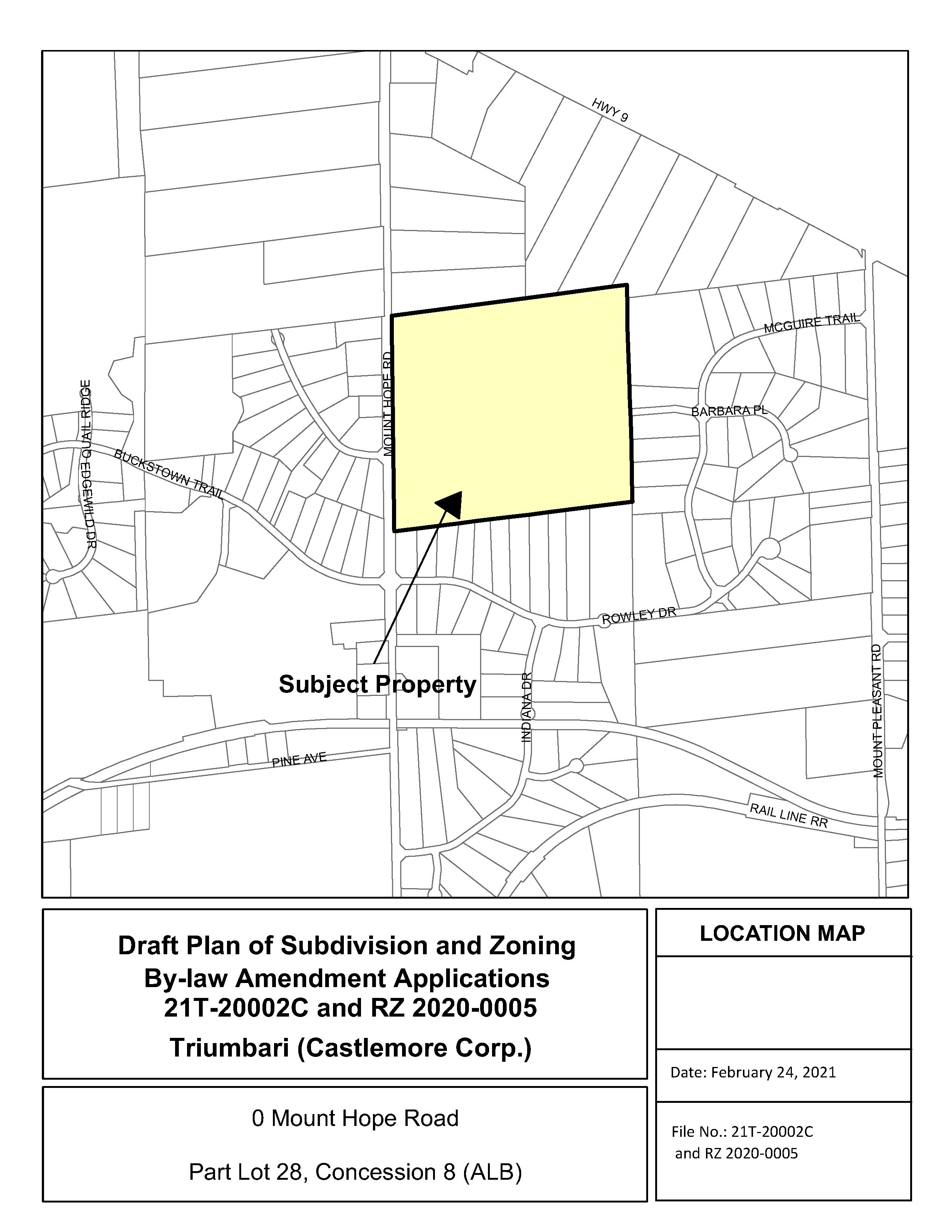
- Draft Plan of Subdivision
The proposed Draft Plan of Subdivision consists of 29 estate residential lots with structure envelopes, an environmental block, new roads and a new road connecting the subdivision to the east to Mount Hope Road.
- Zoning By-law Amendment
The proposed Zoning By-law Amendment proposes to amend the zoning from Rural – Oak Moraine (A2-ORM) and Environmental Policy Area 2 Zone – Oak Ridge Moraine (EPA2 – ORM) to Estate Residential – Exception XX – Oak Ridges Moraine (RE-XX-ORM) to include site specific provisions for building and structure location and natural area restrictions.
Updates and Notices
- Notices
- Notice of Application and Public Meeting – Posted April 15, 2021
- Notice of Second Public Meeting - Posted February 24, 2022
- Material Submitted
- Pre-Consultation (DART) Meeting Form
- Draft Plan of Subdivision Application
- Zoning By-law Amendment Application
- Cover Letter
- Draft Zoning By-law Amendment
- Parcel Abstract
- Planning Justification Report
- Arborist Report and Tree Preservation Plan
- Environmental and Engineering Summary Report
- Erosion Control Plan
- Preliminary Geotechnical Investigation
- Healthy Development Assessment
- Nitrate Impact Assessment
- Landform Conservation Plan
- Natural Heritage Assessment (including Species at Risk Assessment)
- Urban Design Brief / Architectural Design Guidelines
- Stage 1 & 2 Archaeological Assessment
- Functional Servicing & Stormwater Management Report
- Existing Drainage Plan
- Proposed Drainage Plan
- Grading Plan
- Erosion & Sediment Control Plan
- Hydrogeological Investigation
- Phase One Environmental Site Assessment
- Phase Two Environmental Site Assessment
- Wellhead Protection Survey
- Landform Conservation Assessment Report
- Legal survey, topographic map, slope analysis map, soil and drainage classification map, surface hydrological map, vegetation and wildlife ecology map, environmental summary
- Sourcewater Protection Questionnaire
- Survey
Contact us, or make an appointment to visit Town Hall to view studies not available online, or previous versions
Lead Planner
Valerie Schmidt, MCIP, RPP, GSP Group
On Behalf Of Development Review Services, Planning Department, Town of Caledon
519-569-8883
vschmidt@gspgroup.ca
Additional Resources
For more information about this matter, or to provide comments, feedback or ask questions, please contact the Lead Planner at Town Hall from Monday to Friday, 8:30 a.m. to 4:30 p.m.