
The Town has received a proposed Official Plan Amendment Application (POPA).
- Current Status
- In Circulation
- Public Meeting Scheduled: October 21, 2025
Property Description
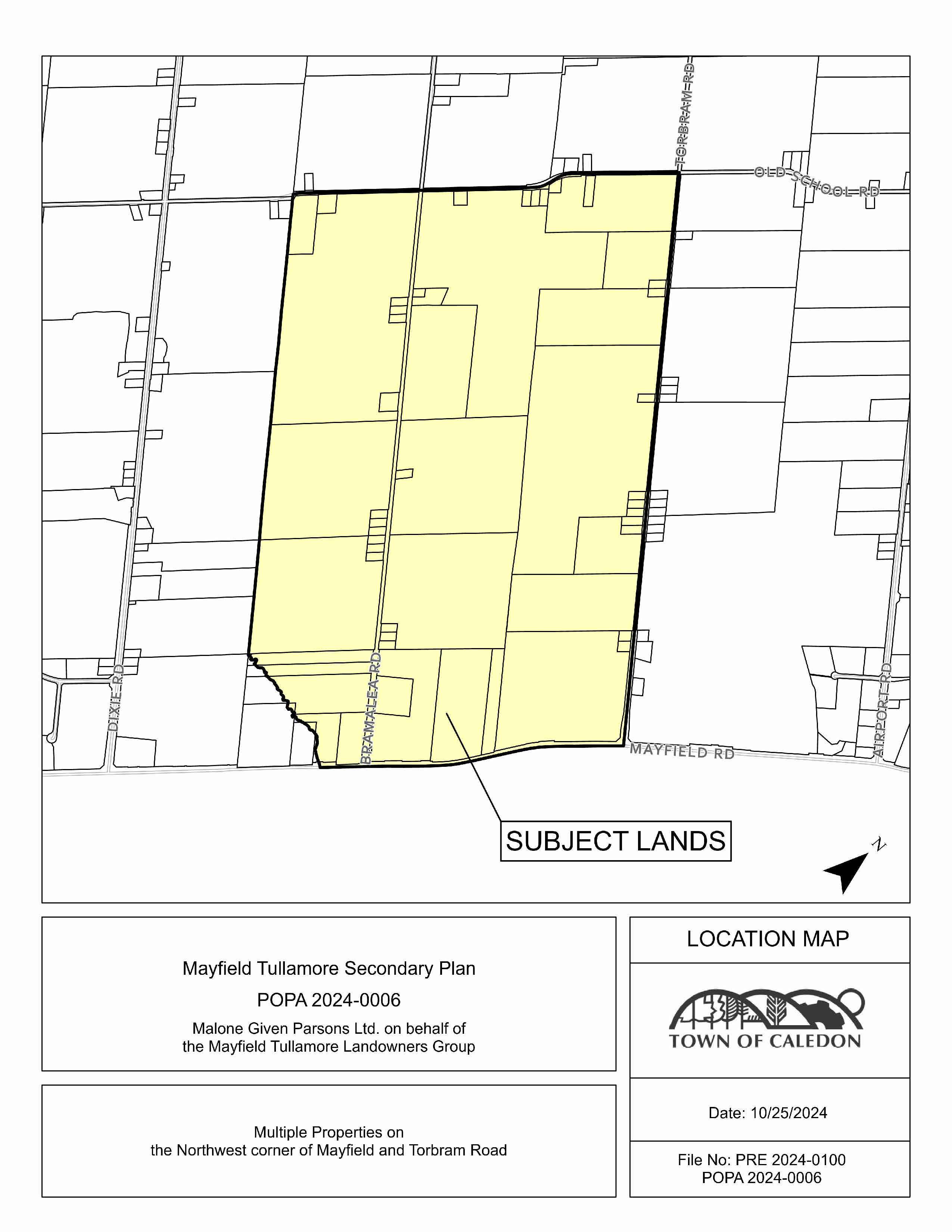
The subject lands are bounded by Old School Road to the north, Torbram Road to the east, and Mayfield Road to the south. They also include properties on the west side of Bramalea Road. Refer to the location map.
- Town File Number(s): POPA 2024-0006
- Project Name: Proposed Mayfield Tullamore Secondary Plan (Malone Given Parsons Ltd. on behalf of Mayfield Tullamore Landowners Group)
- Wards 2 & 3
- Location Map
- Official Plan Amendment
The proposed Mayfield Tullamore Secondary Plan covers an area of approximately 609 hectares (1,505 acres). Of this total, approximately 217 hectares are comprised of Greenbelt Plan Area and existing natural heritage features. The result is a net developable area of approximately 392 hectares.
The proposed secondary plan would include neighbourhood areas, urban corridors, neighbourhood centres (residential and mixed-use areas), parks and open space, schools, and community facilities. It would enable the development of approximately 7,650 new homes (a mix of detached, semi-detached, townhouse and apartment dwellings) through future development applications. It would also provide for approximately 2,000 population-related jobs.
Updates and Notices
- Meetings and Notices
- Notice of Public Information Meeting - Posted November 6, 2024
- Notice of Application - Posted May 8, 2025
- Notice of Public Meeting - Posted September 25, 2025
- Materials Submitted - 1st Submission
- Cover Letter
- Acknowledgement of Public Information , signed by Malone Given Parsons Ltd.
- Draft Official Plan Amendment and Secondary Plan
- Proposed Land Use – Amendment Schedule
- Agricultural Impact Assessment
- Archaeological Assessment Stage 1
- Commercial Impact Study
- Community & Sustainability Design Guidelines
- Cultural Heritage Analysis
- Fiscal Impact Study
- Healthy Development Assessment
- High Level Background Servicing and Stormwater Management Analysis
- Planning Opinion Report
- Public Consultation Strategy
- Transportation Impact Study
- Phase 1 – Subwatershed Characterization and Integration Report
- Phase 1 – Subwatershed Characterization and Integration Report (Part 1)
- Phase 1 – Subwatershed Characterization and Integration Report (Part 2)
- Phase 1 – Subwatershed Characterization and Integration Report (Part 3)
- Appendix A - Terms of Reference, dated August 2024
- Appendix B - Natural Heritage
- Appendix C - Fluvial Geomorphology
- Appendix D - Hydrology and Hydraulics
- Appendix E - Geotechnical and Hydrogeology
- Indigenous Engagement Letter
- Climate Adaptation Plan
- Phase 2 Local Subwatershed Study
Contact us, or make an appointment to visit Town Hall to view studies not available online, or previous versions.
- Materials Submitted - 2nd Submission
Lead Planner
Giuseppe Russo
Community Planner, Planning Development
905-584-2272 ex. 4772
giuseppe.russo@caledon.ca
Additional Information
For more information about this matter, or to provide comments, feedback or ask questions, please contact the Lead Planner at Town Hall from Monday to Friday, 8:30 a.m. to 4:30 p.m.